beforecontenttitle
COPERNICUS Activation
Después del título del contenido
Antes del cuerpo del contenido
Trozos html editables
Trozos html editables
 | The Spanish General Directorate of Civil Protection and Emergencies (CENEM) triggered the Copernicus Emergency Management Service (CEMS) Risk and Recovery Mapping to develop tsunami risk analysis in the urban environments along 300 km of the Andalusian West Coast, totaling an area of about 6,780 km2. This activation supports civil protection preparedness activities in the area, and its results include information on tsunami hazard, exposure, and vulnerability of the buildings. The risk and recovery mapping products depict the reference datesets, model tsunami hazard via highly efficient numerical simulations (Tsunami-HySEA), and calculate the tsunami vulnerability returning a Relative Vulnerability Index for each building of the area of interest. |
Link to Copernicus Emergency Service - mapping web page
EMSN-078: Tsunami preparedness risk assessment in Andalusian West Coast, Spain 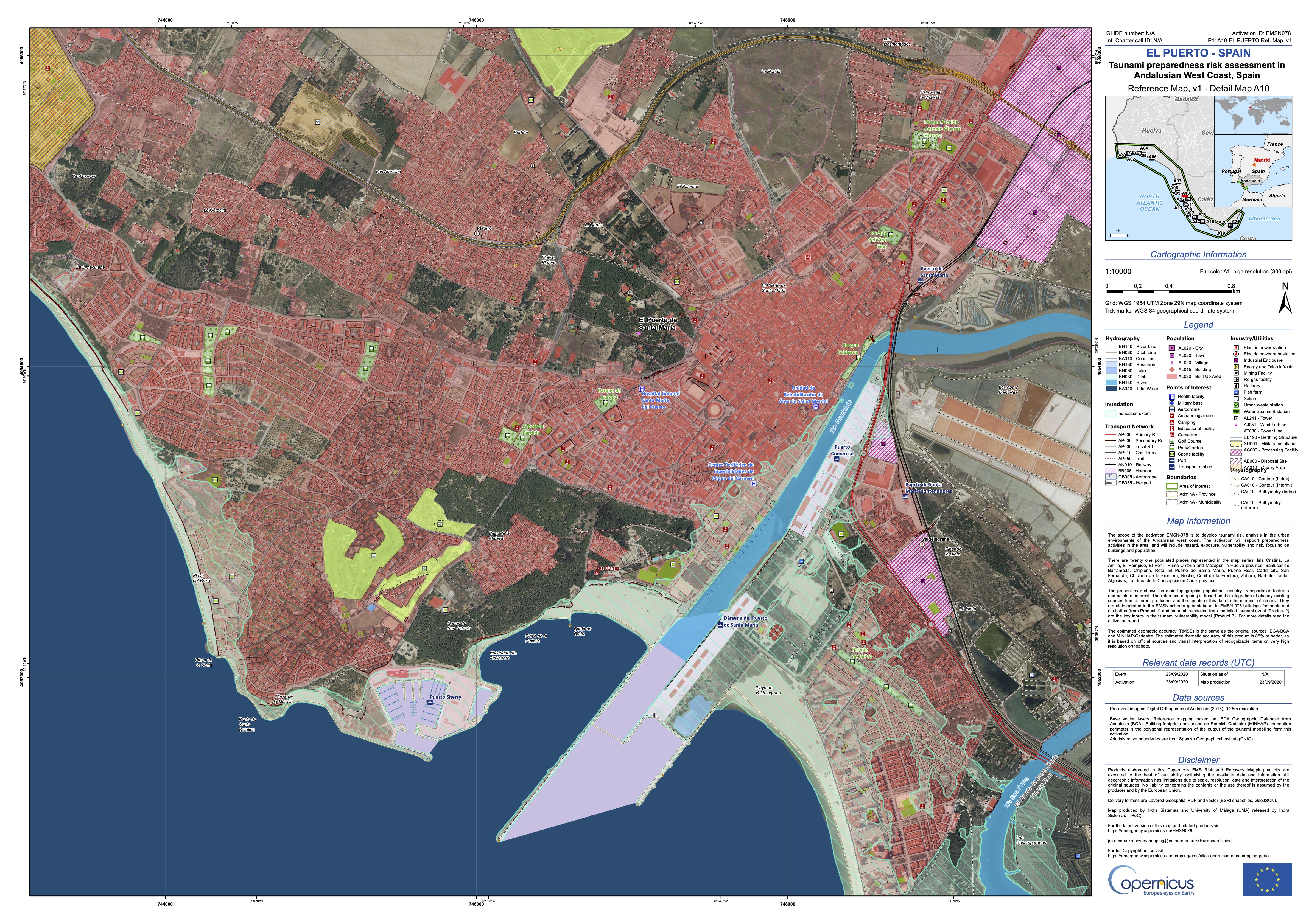 |
- Reference: Framework Service Contract No. 937978 IPR 2019 - Ref. OTRI 8.06/33.5688
- Funding institution: Joint Research Center (JRC) - EC
- Partners: INDRA/UMA as subcontractor
- Duration: 01/07/2020 - 30/09/2020
- PI UMA: Dr. D. Jorge Macías Sánchez
Después de cuerpo del contenido


